-
If you are citizen of an European Union member nation, you may not use this service unless you are at least 16 years old.
-
You already know Dokkio is an AI-powered assistant to organize & manage your digital files & messages. Very soon, Dokkio will support Outlook as well as One Drive. Check it out today!
| |
Blue Ridge Parkway
Page history
last edited
by Karl Martyn 12 years, 7 months ago
Highlights in North Carolina

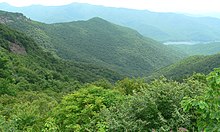
The Cascades along the Blue Ridge Parkway
The Blue Ridge Parkway crosses the North Carolina-Virginia state line at mile 216.9. The 1749 party that surveyed the boundary included Peter Jefferson, father of Thomas Jefferson.
- Mile 217.5 Cumberland Knob, at 2,885 feet (879 m), is a delightful spot to walk through fields and woodlands.
- 218.6 Fox Hunters Paradise, a 10-minute walk, is where hunters could listen to their hounds baying in the valley below.
- 238.5 Brinegar Cabin was built by Martin Brinegar about 1880 and lived in until the 1930s when the homestead was purchased from his widow for the parkway. The original cabin stands there today.
- 238.5 to 244.7 Doughton Park was named for Congressman Robert L. Doughton, a staunch supporter and neighbor of the parkway. One of the best places to see deer. Campground.
- 258.6 Northwest Trading Post offers crafts from North Carolina's northwestern counties.
- 260.6 Jumpinoff Rock, at the end of a short woodland trail, offers a beautiful vista.
- 264.4 The Lump provides sweeping views of the forested foothills.
- 272 E. B. Jeffress Park has a self-guided trail to the Cascades. Another trail goes to the old cabin and church.
- 285.1 Daniel Boone's Trace, which Boone blazed to the West, crosses near here.
- 292 to 295 Moses H. Cone Memorial Park has hiking, fishing and horse trails. Flat Top Manor, the house of Moses H. Cone has Parkway Craft Center.
- 295.1 to 298 Julian Price Memorial Park, the former retreat of the insurance executive Julian Price, offers a variety of short trails and a 47-acre (190,000 m2) lake.
- 304.4 Linn Cove Viaduct, a design and engineering marvel, skirts the side of Grandfather Mountain. Visitor center and trails.
- 308.3 Flat Rock is worth the walk for the superb view of Grandfather Mountain and Linville Valley.
 
The  view from Craggy Gardens on the Blue Ridge Parkway. view from Craggy Gardens on the Blue Ridge Parkway.
- 316.3 Linville Falls roars through the dramatic rugged Linville Gorge. Trails to overlooks.
- 320.7 Chestoa View trail provides outstanding scenery.
- 331 Museum of North Carolina Minerals interprets the state's mineral wealth.
- 339.5 Crabtree Meadows & Crabtree Falls (North Carolina) Campground, Giftshop & Hiking Trails to Crabtree Falls.
- 355.4 Mount Mitchell State Park, reached via N.C. 128, has a picnic area, lookout tower, and the highest point east of the Mississippi River.
- 361.2 Glassmine Falls, an 800-foot (240 m) ephemeral waterfall visible from an overlook on the side of the parkway.
- 363.4 to 369.6 Craggy Gardens in the Great Craggy Mountains appear covered with purple rhododendron in mid to late June. Craggy Pinnacle Trail and other trails (364.1 and 364.6); road to picnic area and trails (367.6).
- 382 The Folk Art Center is the flagship facility of the Southern Highland Craft Guild. It offers sales and exhibits of traditional and contemporary crafts of the Appalachian region. Interpretive programs, three galleries, a library and a book store.
- 384 The Blue Ridge Parkway Visitor Center is the newest attraction along the Parkway. The building itself is LEED- certified [1] and reflects the cutting edge of energy-saving technology. The Center houses a 70-seat theater showing an award-winning 24 minute film about the region. Information and orientation services are provided by the National Park Service and the Blue Ridge National Heritage Area. Eastern National has a retail shop offering books, apparel and more. There are several exhibits, including a 22-foot interactive map of the entire Blue Ridge Parkway known as the "I-Wall" which provides multi-media information on places to visit on and around the Parkway. Other exhibits focus on the history and heritage of the Parkway and Western North Carolina. Open year-round from 9am-5pm.
- 408.6 Mount Pisgah was part of the Biltmore Estate. The estate became home of the first forestry school in America and the nucleus of the Pisgah National Forest.

- 417 Looking Glass Rock is visible from many spots on the Parkway starting at Mount Pisgah.
- 418 East Fork Overlook. Located here are the headwaters of the Pigeon River. Yellowstone Falls is a short distance away and gets its name from the yellowish moss covering the rocks. You can find U.S. Forest Service trail access to Shining Rock Wilderness Trail system here.

 East Fork Overlook from Blue Ridge Parkway - 420.2 Shining Rock Wilderness is the largest Wilderness in North Carolina with 18,483 acres (74.80 km2), 25 miles (40 km) of trails and peaks over 6,000 ft (1,800 m). The Wilderness is named for Shining Rock.
- 420.2 Black Balsam Knob is a grassy bald with panoramic views just outside of the Shining Rock Wilderness in Pisgah National Forest. The Wilderness also includes Cold Mountain.
- 422.4 Devil's Courthouse is a rugged exposed mountaintop rich in Cherokee traditions. A walk to the bare rock summit yields a spectacular view of Pisgah National Forest.
- 423.5 Herrin Knob Overlook. A hiking trail goes around Tanasee Bald and Herrin Knob. Tanasee Bald (423.7) is said to be the home of the mythical Cherokee giant Tsul 'Kalu.
- 431 Richland Balsam's self-guiding trail takes you through a remnant spruce-fir forest. Highest point on the parkway, 6,053 feet (1,845 m).
- 451.2 Waterrock Knob provides a panorama of the Great Smokies, visitor center, trail, confort station, exhibits.

- 458.2 Heintooga Overlook spur road goes to a mile-high overlook 1.3 miles (2.1 km) from the parkway.

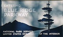
 Sign marking the southern end of the Blue Ridge Parkway, near Great Smoky Mountains National Park
Blue Ridge Parkway
|
|
Tip: To turn text into a link, highlight the text, then click on a page or file from the list above.
|
|
|
|
|
Comments (0)
You don't have permission to comment on this page.